Hema Australian Maps
Choose up to 4 products to compare
Products 1-48 of 62
Show
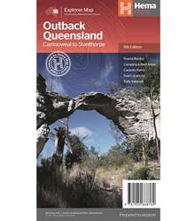
Item #: 9781922668769 -
Outback Queensland Map (5th Edition) - contains mapping and visitor information for one of the most iconic regions in Australia from the inland borders to Toowoomba in the east and Charters Towers in the north. Mapping at a scale of 1:1,500,000 covers from the inland borders to Toowoomba in the east and Charters Towers in the north, with hill shading and elevation tinting creating a more realistic interpretation of the landscape within the region. Marked on the map are: Points of interest...
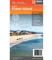
Item #: 9781922668783 -
Fraser Island (K'gari) is one of the most diverse 4WD destinations in Australia, with beaches, rainforests, perched lakes, sand blows and more fitting into the world’s largest sand island. The mapping is highly detailed (1:130,000), with 4WD tracks field checked by the Hema Map Patrol, while hybrid satellite inset maps of Waddy Point, Orchid Beach, Cathedral Beach, Happy Valley, Kingfisher Bay, Eurong and Second Valley are also included. On the reverse is a wealth of information for enjoying...
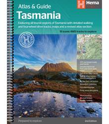
Item #: 9321438001973 -
The definitive guidebook for discovering Tasmania, featuring the Top 15 4WD Trips of the State and 5 of the best walking tracks. This edition of the Tasmania Atlas & Guide contains 40 atlas pages at a large scale of 1:150 000 in a stunning cartographic style. The guide features the Top 15 4WD Trips for Tassie, which has been field checked by Hema's Map Patrol. Also included is an introduction to the region, as well as information sections on planning the trip and what to see and...
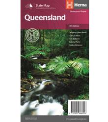
Item #: 9781922668806 -
The thirteenth edition of Hema’s Queensland State Map features Hema’s distinctive and informative maps fully, all of which have been field checked by Hema’s Map Patrol to ensure the best possible accuracy with the latest mapping data. A fully indexed state map of Queensland (QLD) at a scale of 2:500,000. Marked on the mapping are national parks, fuel locations as well as camping and rest areas. The reverse side consists of: a summary of the key things to see and do in Queensland a table...
Item #: 9781922668776 -
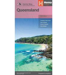
A compact map of Queensland (QLD) at a scale of 1:2,500,000 for touring throughout the state which features highways, major roads and minor roads. Marked on the map are national parks, camping areas, caravan parks, rest areas, points of interest and 24-hour fuel accompanied by a distance grid and an index. Features: 24-hour fuel National parks Camping areas Rest areas Fully indexed Product Details: Edition: 15
Media: Map
Weight: 0.08 kg
Folded size (WxHxD): 125 mm X 250 mm x 3...
Item #: 9781922668202 -
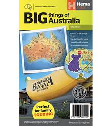
This colourful and easy-to-use map of Australia is the only map on the market featuring a full list of the big things of Australia and includes Hema's top 30 icons prominently displayed on the map plus a description of each on the reverse side of the map. See how many you can tick off on your big lap!. Key Features Full list of 'Big Things' of Australia plotted on the Hema Map Hema's top 30 'Big Things' prominently displayed on the map with detailed information on the reverse side...
Item #: 9781922668189 -
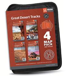
Hema’s Great Desert Tracks Map Pack The Great Desert Tracks Map Pack presents Hema's iconic Great Desert Tracks series in a soft and durable map wallet. Explore the arid centre with these comprehensive maps that traverse Australia's desert regions — each map waterproof, tear proof and field-checked by the Hema Map Patrol to ensure the accuracy and detail necessary for desert travel. With complete coverage of the outback region of Australia's centre, the Great Desert Tracks Map Pack is the...
Item #: 9781922668080 -
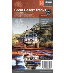
Hema's Great Desert Tracks maps are essential for anyone travelling in the Australian outback. The mapping features roads and 4WD tracks field-checked by the Hema Map Patrol, Points of Interest for remote area travellers and touring information for learning more about the region and planning your journey. The Great Desert Tracks Central Sheet covers from Judbarra/Gregory National Park in the north to Ceduna in the south, and from Halls Creek in the west to Coober Pedy in the east. Marked...
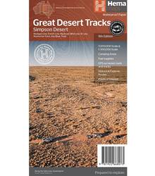
Item #: 9781922668073 -
Hema's Great Desert Tracks maps are essential for anyone travelling in the Australian outback. The mapping features roads and 4WD tracks field-checked by the Hema Map Patrol, Points of Interest for remote area travellers and touring information for learning more about the region and planning your journey. Discover the Simpson Desert with detailed mapping, relevant points of interest and essential touring information for the journey. One side of the map covers the desert at a scale of...
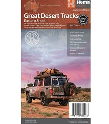
Item #: 9781922668066 -
Hema's Great Desert Tracks maps are essential for anyone travelling in the Australian outback. The mapping features roads and 4WD tracks field-checked by the Hema Map Patrol, Points of Interest for remote area travellers and touring information for learning more about the region and planning your journey. The Great Desert Tracks Eastern Sheet covers from Tennant Creek in the north to Port Pirie in the south, and from Cunamulla in the east to Alice Springs in the west. Marked on the mapping are...
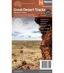
Item #: 9781922668059 -
Hema's Great Desert Tracks maps are essential for anyone travelling in the Australian outback. The mapping features roads and 4WD tracks field-checked by the Hema Map Patrol, Points of Interest for remote area travellers and touring information for learning more about the region and planning your journey. The Great Desert Tracks Western Sheet covers from beyond Derby in the north to Norseman in the south, and from Halls Creek in the east to Marble Bar in the west. Marked on the mapping are...
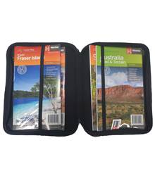
Item #: 9321438002505 -
Get Hema's sturdy and compact Atlas & Map wallet to protect and safely store your atlas and maps. This compact map wallet holds one A4 sized atlas or book and four standard folded maps. Features: perfect for organising and protecting your atlas and maps in one place This wallet holds one A4 sized atlas or book and four standard folded maps (not included) Please note : Maps and atlas are for display purpose only Product Details: Brand: Hema
Manufacturer Colour: Black
Weight: 0.24 kg
Length:...
Item #: 9321438002451 -
Get Hema's sturdy and compact map wallet to protect and safely store your maps. This compact map wallet holds up to 10 maps. Features: Organise and protect your Hema Maps with this sturdy map wallet The compact map storage holds up to 10 Maps (no included) Please note : Maps are for display purpose only Product Details: Brand: Hema
Manufacturer Colour: Black
Weight: 0.17 kg
Length: 28 cm
Width: 22 cm
Depth: 4 cm ...
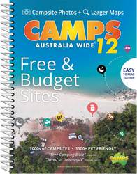
Item #: 9780994532770 -
Camps 12 is the only guide you will need for free and low-cost camping across Australia, featuring verified free and budget camps. Travellers can tell if a site is free or paid, national parks, state forests, showgrounds, pub stays, RV parks, stations and farm stays on the maps and listings. Only remote caravan parks that are important wayfinders or outback roadhouses are found in this streamlined edition. (Hard Cover, Spiral Bound, B4 Edition.) What's new in Camps 12? More focus on free and...
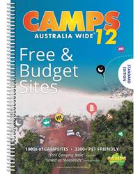
Item #: 9780994532763 -
Camps 12 is the only guide you will need for free and low-cost camping across Australia, featuring verified free and budget camps. Travellers can tell if a site is free or paid, national parks, state forests, showgrounds, pub stays, RV parks, station and farm stays on the maps and listings. Only remote caravan parks that are important wayfinders or outback roadhouses are found in this streamlined edition. What's new in Camps 12? More focus on free and low-cost sites than ever beforeLatest new...
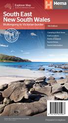
Item #: 9781925625967 -
A regional map of South East New South Wales (1:385,000) that ranges from Wollongong down to the Victoria border and out to Gundagai and past Jindabyne in the West. Covered regions in the map include; Illawarra, Jervis Bay & Shoalhaven, Batemans Bay, Canberra & surrounds, Merimbula & Sapphire Coast, Southern Highlands, Goulburn Region and the Snowy Mountains. On the opposite side is extensive information on numerous regions, including visitor, historical and...
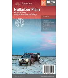
Item #: 9781925625981 -
This map is part of Hema's new Nullarbor Plain Map Series and covers the area from Kalgoorlie to Border Village and its surrounds. Truly one of the worlds great adventure drives, Australia's semi-arid Nullarbor Plain stretches some 1,256 kilometres (781 miles) via the Eyre Highway and links the cities of Adelaide and Perth (or vice versa depending on your direction). The length of this journey is so large we needed to stretch it over two maps; East from Port Pirie to Border Village in...
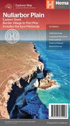
Item #: 9781925625998 -
This map is part of Hema's new Nullarbor Plain Map Series (East and West) and covers Border Village to Port Pirie including the Eyre Peninsula. Truly one of the worlds great adventure drives, Australia's semi-arid Nullabor Plain stretches some 1,256 kilometres (781 miles) via the Eyre Highway and links the cities of Adelaide and Perth (or vice versa depending on your direction). The length of this journey is so large we needed to stretch it over two maps; East from Port Pirie to...
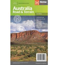
Item #: 9781925625943 -
Hema’s iconic large map of Australia is coloured to reflect the country's climate zones. Marked on the map are localities, the major road network, distances and major national parks. The visual appeal makes it perfect as a decorative map or an educational tool. On the reverse side is an overview of Australia's iconic touring regions featuring history, geology and landforms, nature, bucket-list attractions and iconic 4WD tracks. Features: Full road and terrain hillshade map Major road networks...
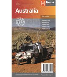
Item #: 9781922668004 -
Hema’s iconic large map of Australia is ideal as a trip planning tool and travel companion. Marked on the map are localities, the major road network, distances and major national parks. The map also shows localities, the major road network, distances and major national parks. The visual appeal makes it perfect as a decorative map or an educational tool. On the reverse side is an overview of Australia's iconic touring regions featuring history, geology and landforms, nature, bucket-list...
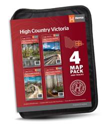
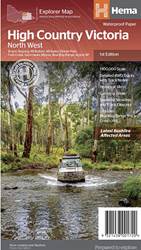
Item #: 9321438002093 -
The Victorian High Country Map Pack presents Hema's iconic The Victorian High Country series in a soft and durable map wallet (including four detailed maps). Explore Victoria's 4WD mecca with these comprehensive maps that traverse one of Australia's most diverse mountainous regions — each map waterproof, tear proof and field-checked by the Hema Map Patrol to ensure the accuracy and detail necessary for travel in this area.Included in each map pack:The Victorian High Country - North Eastern Map...
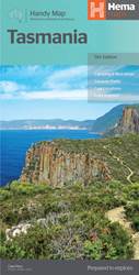
Item #: 9321438002246 -
Tasmania Handy Map (11th Edition) - A compact map of Tasmania for touring throughout the state with a distance grid and index for planning and reference. Marked on the mapping are highways, major and minor roads, camping and rest areas, 24-hour fuel, information centres, picnic areas, caravan parks and lookouts. Key features: Camping areasCaravan ParksFully indexedEasy to use ...
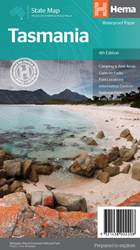
Item #: 9321438002208 -
A fully indexed state map of Tasmania at a scale of 1:500,000. Marked on the mapping are national parks, 24-hour fuel as well as camping and rest areas. On the reverse are detailed maps of the Zeehan and Region (including Lake St Clair and Franklin-Gordon Rivers National Park), Freycinet National Park, Southwest National Park and Hobart & Region Complete list of Tasmanian Visitor Information Centres. The reverse side consists of: A summary of the key things to see and do broken up into the...
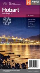
Item #: 9321438002253 -
This first edition of Hema’s Hobart & Region Map features Hema’s distinctive and informative maps fully, all of which have been field checked by Hema’s Map Patrol to ensure the best possible accuracy with the latest mapping data. This map has the greater Hobart region on one side (1:35,000) in detail and a lower scale overview map of the Hobart CBD (1:14,000), Launceston city and region (1:25,000) plus a broader Greater Hobart area (1:250,000) map on the reverse side. Hobart is Tasmania's...
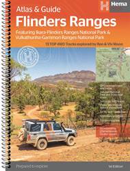
Item #: 9321438001676 -
This edition of Hema’s best-selling outdoor guidebook for discovering the Flinders Ranges now features 20 atlas pages at a large scale of 1:150 000 in a stunning cartographic style. The guide features 13 of the best 4WD Trips for the Flinders Ranges, which has been written by off-road legend Ron Moon. Also included is an introduction to the region, as well as information sections on planning the trip and what to see and do. There are detailed touring sections on the distinct regions of...
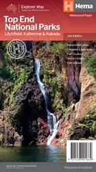
Item #: 9321438001669 -
A regional map that features Litchfield (1:160,000), Katherine Gorge and Kakadu (1:350,000) national parks. A Darwin region map is included (1:850,000) along with extensive tourist information for Darwin and the surrounding region, Arnhem Highway to Kakadu, Mary River, Stuart Highway to Katherine, Litchfield National Park, Katherine Gorge (Nitmiluk) National Park and Kakadu National Park. Also included are national park facility listings in addition to contact details for accommodation and...
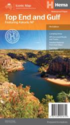
Item #: 9321438001614 -
This regional waterproof map of the Top End and Gulf is ideal for discovering the northern parts of Australia's NT by 4WD. It includes a main map of the Darwin region, Judbarra / Gregory National Park, Nhulunbuy, Keep River National Park and Boodjamulla (Lawn Hill) National Park. There is additional tourist information for Arnhem Land, the Roper River trek, Darwin region, Douglas-Daly district, Nature’s Way, Victoria Highway, Katherine Region and the Stuart Highway Region. Features: GPS...
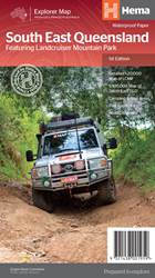
Item #: 9321438001959 -
South East Queensland featuring Landcruiser Mountain Park Map (1st Edition) - stretches from the New South Wales-Queensland border to past Bundaberg, with a detailed map and information on the Landcruiser Mountain Park on the opposite side.Features: Detailed Inset Map of Landcruiser Mountain Park and additional information about this iconic 4WD destinationCamping and rest areasCaravan ParksFuel LocationsNational parksBrisbane region suburb and location index Scale: 1:500,000Folded size...
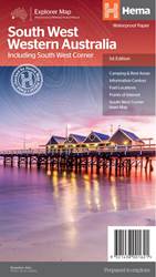
Item #: 9321438001621 -
A regional map for discovering South West Western Australia (WA). On the reverse side of the map are detailed inset maps of Nambung National Park, Avon Valley National Park, Lane Poole Reservation, the South West Corner, Stirling Range National Park, D, Entrecastreaux National Park and Albany Coast. Also included is tourist information for the Coral Coast, Perth, Avon Valley, the Great Southern Region, Peel, Blackwood River Valley, the Southern Forests, the Margaret River region and the...
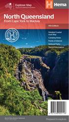
Item #: 9321438002116 -
North Queensland Map (11th edition) - this is the ideal North Queensland map for discovering the many destinations between Mackay and The Tip. The mapping is at a touring scale of 1:750,000, with terrain shading and touring symbols giving an accurate and informative overview of the region. There is a detailed inset map for Mackay and the Whitsundays and another for the entire coastal strip between Townsville and Cooktown. There is also tourist information on the popular coastal strip with...
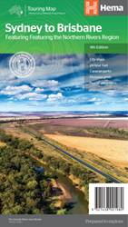
Item #: 9321438001980 -
Sydney to Brisbane Map (13th edition) - a city to city map designed for the journey from Sydney to Brisbane via the Pacific and New England Highways (1:1,000,000), with tourist information on towns and regions within the trip on the opposite side. Features: City maps 24-hour fuel Camping areas Distance grids Tourist attractions Roadside rest areas Scale: 1:1,900,000 Folded size (WxHxD): 140mm x 250mm x 3mm Flat size (WxH): 700mm x 1000mm ...
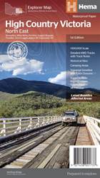
Item #: 9321438001720 -
This map is part of Hema's new Victorian High Country Map Series and covers the North Western Alps Area including Hotham, Wangaratta and surrounds. Printed on durable waterproof paper, this map features Hema's iconic mapping and extensive points of interest. Featuring roads and 4WD tracks field-checked by the Hema Map Patrol for superior accuracy. It combines Hema’s entire database of roads and 4WD tracks with touring points of interest and topographic information. Also included are seasonal...
Item #: 9321438001751 -
This map is part of Hema's new Victorian High Country Map Series and covers the Southern Ranges Areas including Baw Baw to Dargo and surrounds. Printed on durable waterproof paper, this map features Hema's iconic mapping and extensive points of interest. Featuring roads and 4WD tracks field-checked by the Hema Map Patrol for superior accuracy. It combines Hema’s entire database of roads and 4WD tracks with touring points of interest and topographic information. Also included are seasonal track...
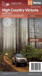
Item #: 9321438001744 -
This map is part of Hema's new Victorian High Country Map Series and covers the Southern Lowlands and Lakes Areas including Gippsland and Snowy River National Park. Printed on durable waterproof paper, this map features Hema's iconic mapping and extensive points of interest. Featuring roads and 4WD tracks field-checked by the Hema Map Patrol for superior accuracy. It combines Hema’s entire database of roads and 4WD tracks with touring points of interest and topographic information. Also...
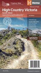
Item #: 9321438001737 -
This map is part of Hema's new Victorian High Country Map Series and covers the Northern Borderlands Area from Omeo to Jindabyne. Printed on durable waterproof paper, this map features Hema's iconic mapping and extensive points of interest. Featuring roads and 4WD tracks field-checked by the Hema Map Patrol for superior accuracy. It combines Hema’s entire database of roads and 4WD tracks with touring points of interest and topographic information. Also included are seasonal track closures,...
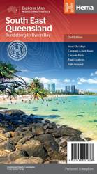
Item #: 9321438001638 -
A regional map of South East Queensland (1:500,000) that stretches from the New South Wales-Queensland border to past Bundaberg, with maps of the Brisbane Region (1:300,000), Brisbane City and the Gold Coast on the opposite side. Features: Inset Maps (Brisbane City and Gold Coast) Camping and rest areas Caravan Parks Fuel Locations National parks Rail and ferry network maps Brisbane region suburb and location index Scale: 1:500,000 Edition:2Publication Date:01/09/2014 ...
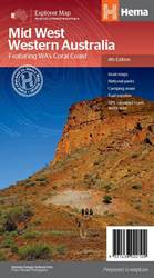
Item #: 9321438002109 -
A regional map of Mid West Western Australia that covers from Cape Range National Park south to Mandurah and as far as Kalgoorlie at a scale of 1:1,250,000 that has camping areas, national parks, fuel supplies and facility symbols marked on the map. On the reverse is region-specific touring information for Wildflower country, Goldfields, Batavia Coast, Geraldton to Kalbarri, Gascoyne and the Outback Coast, Carnarvon and the Blowhole Coast as well as the Great Eastern Highway, with detailed...
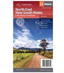
Item #: 9321438001652 -
A regional map of North East New South Wales (1:375,000) that is the perfect companion for touring through North East New South Wales (NSW). The map features information on the major touring routes through the region including the Summerland Way, Bruxner Highway, Waterfall Way and Gwydir Highway, as well as major tourist attractions along both the Pacific Highway and the New England Highway. Also included are listed national parks within the region, contact information and events. Key...
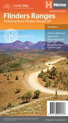
Item #: 9321438001607 -
A waterproof map of the Flinders Ranges with inset national park maps of Flinders Ranges National Park and Vulkathunha-Gammon Ranges National Park. Visitor information for both the national parks, the Leigh Creek region and the Blinman region make trip planning and navigation simple, with accompanying tourist information including self-drive treks, historic sites, necessary contact details and listed national parks and reserves. Key features: GPS surveyed roads and tracks Self-drive 4WD tracks...
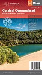
Item #: 9321438001584 -
A regional map of central Queensland (1:1,000,000) that stretches inland past Jericho and from Maryborough in the south to Mackay in the north. On the opposite side is tourist information on the region, as well as inset maps of Mackay, the Capricorn Coast, Gladstone, Bundaberg, Rockhampton, and the Gemfields. Accompanying each inset map are photos as well as background and travel information on the region that help for planning and touring.Features: Inset town and city mapsNational...
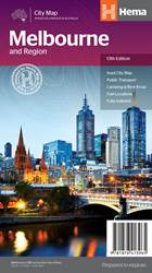
Item #: 9781876413965 -
The Melbourne and Region map features a primary map of Greater Melbourne (1:115,000) that includes highways, major roads and local streets, as well as 24-hour fuel, parks and caravan parks. On the reverse is a Melbourne CBD map with accommodation, shopping and other places of interest pinpointed, along with train and tram network maps and a Melbourne Region map.The cosmopolitan capital of Victoria, Melbourne is a city of distinct districts: each with its own particular appeal. For a different...
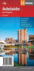
Item #: 9781925625158 -
Hema's Adelaide and Region Map features a primary map of greater Adelaide at a 1:80,000 scale that includes major highways, regional and local roads, as well as 24-hour fuel stops, caravan parks and other Points of Interest. On the reverse side is a detailed map of the Adelaide city centre, featuring the best in accommodation, restaurants and theatres. Also included is a Barossa Valley map and a rail network map. This is the perfect map for planning a weekend escape to Adelaide and navigating...
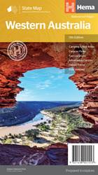
Item #: 9321438001553 -
A state touring map of Western Australia (WA) featuring: Camping and rest areas Caravan parks Fuel locations Information centres Desert tracks Full index Waterproof paper Folded size (WxHxD): 140mm x 250mm x 3mm Flat size (WxH): 700mm x 1000mm Scale: 1:2500000 On the reverse side of the maps are the CBD and through road maps of Perth, plus inset maps of Leeuwin-Naturaliste National Park, Cape Range National Park, Nambung National Park, Francois Peron National Park, Purnululu National Park,...
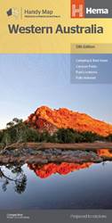
Item #: 9321438001560 -
A compact map of Western Australia for touring throughout the state with a distance grid and index for planning and reference. Marked on the mapping are highways, major and minor roads, camping and rest areas, 24-hour fuel, information centres, picnic areas, caravan parks and lookouts. Features: Camping areasCaravan ParksFully indexedEasy to useUnfolded Size (WxH) - 500mm X 875mmCover Size (WxHxD) - 125mm x 250mm x 3mm Edition:13Publication Date:01/11/19 ...
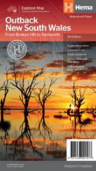
Item #: 9321438001577 -
A regional map of outback NSW (1:1,100,000) that ranges from Tamworth in the east to Broken Hill in the west, as well as from Wagga Wagga in the south to past the Queensland border in the north. On the opposite side is extensive information on numerous regions, including visitor, historical and background information. Covered regions include the Broken Hill region, Corner Country, east of Tibooburra, the White Cliffs region, Cobar and surrounds, around Back o'Bourke, Lightning ridge and...
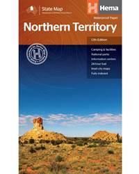
Item #: 9321438001508 -
A touring map of the Northern Territory that has camping and rest areas, 24hour fuel and points of interest marked on the mapping. On the reverse are CBD maps of Darwin and Alice Springs, a map of the greater Darwin region and maps of Yulara, Uluru and Kata Tjuta with walking tracks, points of interest and accommodation included. For trip planning there is a national park matrix and contact details for information centres. PRODUCT FEATURES GPS surveyed roads and tracks Fuel stops 4WD tracks...
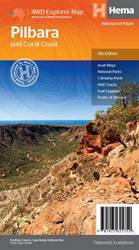
Item #: 9781925625752 -
This regional waterproof map of the Pilbara and Coral Coast is ideal for discovering the northern reaches of Western Australia. The main map covers the diverse marine attractions around Shark Bay, François Peron National Park and the Ningaloo Reef. It also stretches to the gorges of Karijini, lush habitats of Millstream Chichester National Park and the magnificent Marble Bar. It also features additional information relating to permits, useful contacts and historical context surrounding some of...
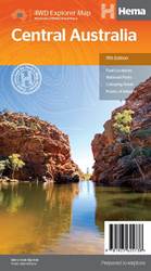
Item #: 9781925625738 -
This waterproof map of the Central Australia region is ideal for discovering some of Australia's most iconic landscapes. The main map covers the area around Alice Springs, including Uluru, Kata Tjuta, West MacDonnell Range, as well as the Simpson Desert and popular tracks such as the Canning Stock Route. It also features additional information relating to permits, useful contacts and historical context surrounding some of the area's most popular tourist destinations. PRODUCT FEATURES GPS...